I’ve put off exploring the Anza-Borrego desert because, frankly, it intimidated me. I had visions of the Sahara, vast expanses of sand and the withered corpses of hapless Mexican border-crossers who perished in motion, reaching out for a distant mirage oasis while rasping the word “water”. What I totally didn’t expect was that it would be so fast to drive to from my house and as easy for me to navigate as any other desert zone I’ve visited. Not only that, but the natives who’ve lived there for millennia were completely fascinating! The Kumeyaay (koo-mee-“I”) (I=eye, like eyeball) were obviously very into studying the sky and they left a lot of evidence of that in interesting ways.
One place I visited on my first dip into Anza Borrego Desert State Park was the mapped Pictograph Trail. I thought, what the heck, it’ll be a quick little jaunt up a well worn trail where I’ll get to see a little bit of local color all pre-packaged for me and easy to enjoy. It was that, but of course I didn’t stay on the main trail and therefore saw so much more than I bargained for.
I need to give a little preamble. Archaeologists believe that the natives lived in the Anza Borrego desert seasonally since about 5,000 B.C.E. (These dates are always disputed as scientific methods improve, but this is a moderately old date within the range that is currently accepted.) In the summer they would live in the mountains, like Mount Laguna, and in the winter they would escape the snow and live in the fertile desert basin where they could roast fresh agave and eat fish from the Salton Sink/Lake Cahuilla. The Old Ones did not use pottery, that only showed up within the last couple hundred years. They occasionally did make petroglyphs (carvings in stone), but they were typically “cupules” (pock marks). Some cupules are thought to correspond to constellations. The pictographs (painted rock art) in Anza Borrego didn’t show up until about 200 or 300 years ago — after the Europeans arrived in Mexico and California. I have an idea that the advent of pottery and painted images on stone were the result of bands of people with different customs and technology fleeing San Diego mission enslavement and encroaching on the ancestral land of groups who had used certain village sites for millennia. I’ll explain more about why I think this in a minute.
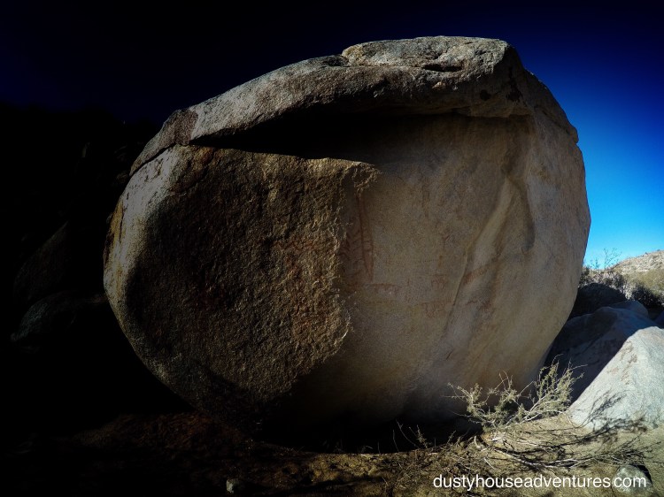
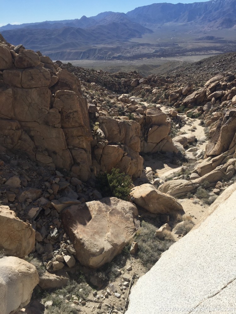
The Pictograph Trail in Smuggler Canyon is a nice wide trail that flows down the middle of a dry wash, leading to a waterfall drop-off into Carrizo Valley. Directly north over the Vallecito and Pinyon Mountains is the village at Mine Wash which I’d explored the day before. I’ll write about that in my next blog post. I chose to start with this one because I had a few interesting clarifying realizations about the Kumeyaay at Smuggler Canyon that informed the rest of my trip. This is the trail that Kumeyaay probably would have followed when moving down from the mountains in the autumn of each year. They would have had to saunter past this enormous stand-alone boulder on the south side of the wash. It is this boulder that has the pictograph panel.
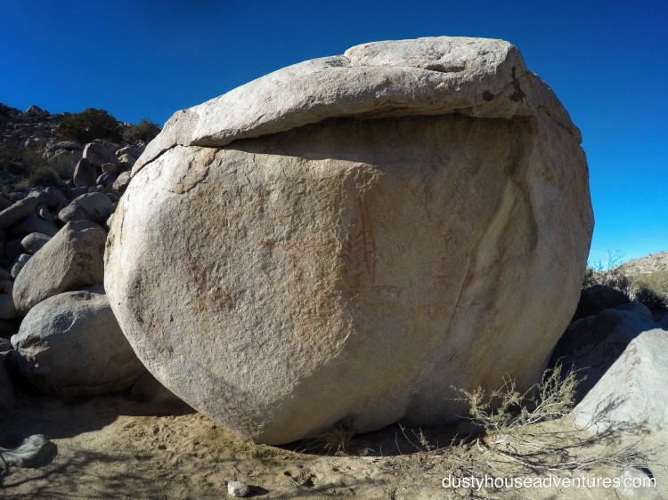
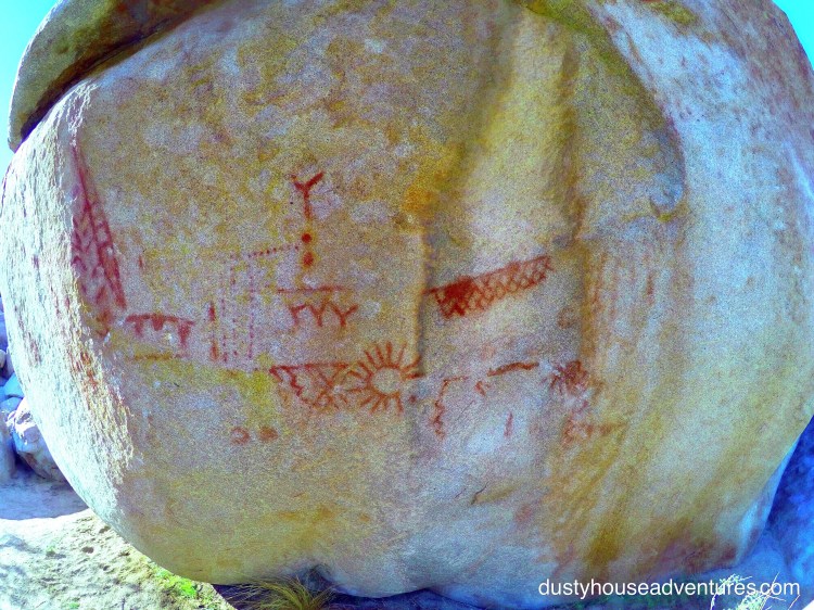
The images are made with yellow and red pigment. Here’s a close-up of the images natural and enhanced.
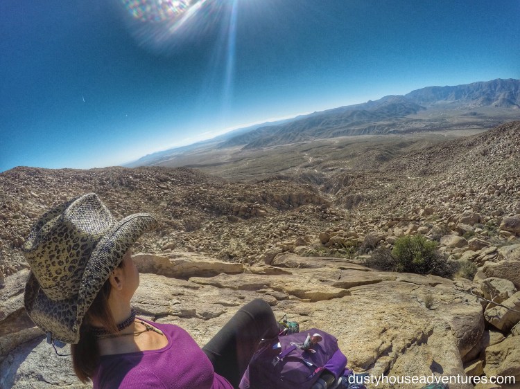
Here’s a picture with me in it for scale. 


The images are supposed to be what’s called the San Luis Rey style. While scholars consistently shy away from making official interpretations of rock art, amateurs are constantly giving it a stab. This gentleman, Ivan, attempted to read the panel as a map to find water. He read it from top to bottom and right to left, and actually had success matching the elements on the panel. I’m excited to return and try it myself using his method to see if I can add anything to the hypothesis. There were some things in his post that he got wrong, like he said the pictograph’s valley didn’t contain a habitation site, which isn’t true, but as with all mysteries, you have to sift through all data for what is true and use it.
These are a few things that I saw and found interesting that I haven’t seen anyone else talk about yet. First, you’ve heard me talk about the Vesica Pices in rock art and naturally occurring geometry. Vesica Pices/yoni/vagina is a symbol that is so fundamental to the atomic geometric construction of all matter in the universe that it appears everywhere and is inescapable as an inherent philosophical concept to all humans whether they realize it or not. It represents creation. Huh? What am I talking about? Well, if you want the long answer, go to this blog post. For the short answer, I’m talking about the egg shape image that is created where two identical circles overlap, intersecting on a shared diameter. This image naturally occurs in nature cracks of rocks and is frequently represented in pictographs as a circle with a line through it.


The Kumeyaay took this imagery a step further and actually found this shape naturally occurring in linear cracks on round boulders and enhanced them by carving them out even more distinctly to make the form prominent.
The boulder displaying the pictograph panel in Smugglers Canyon has a giant Vesica Pices right down the middle of it.
Also, on the side panel that faces the sunrise there is a stand-alone image that is different from the others. Since it has angular sun exposure, the sun can cast a shadow on it that changes angle through midday when the sun passes over the rock to start setting in the east.


I am struck by how much this stand-alone image reminds me of the aboriginal art from Mexico (just a few miles away) as appears in the Dresden Codex and the Codex Cospi.

The Dresden Codex is book of knowledge, images and calendar information recorded by the Maya of Chichen Itza in the early 1300’s. The images in the Dresden Codex all face left.
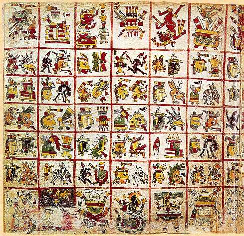
The Codex Cospi is a native manuscript from Puebla Mexico (non-Aztec) that was probably recorded in the 1400’s. All images in the Codex Cospi face right.

I wonder if this large stand-alone image on the sun-facing exposure of the boulder is a family crest of sorts. The village this trail leads to was in use for thousands of years and in all that time nobody ever painted up the place. Suddenly, about 200 or 300 years ago people show up and make this painting. This makes me wonder if the painters of the panel were actually from an invading pictograph-making clan who took over this canyon and wanted to mark it as their own. I imagine that people who did not submit to enslavement by the San Diego Mission or die of disease from European contact found refuge in new environments. I think it is reasonable to imagine that desperate people would have become a little pushy about staking their claim to a new territory. The panel is kind of unusual in that it is SO visible to passers-by. In my experience, pictograph panels are typically on the back-side of a big boulder that you would never expect to have anything on it, or tucked into a cave. They are very rarely spread out for all the world to see like a giant billboard. The people who made this panel definitely had something important to say and wanted anyone who entered this canyon, either from the desert floor or over the mountain, to see it first thing.
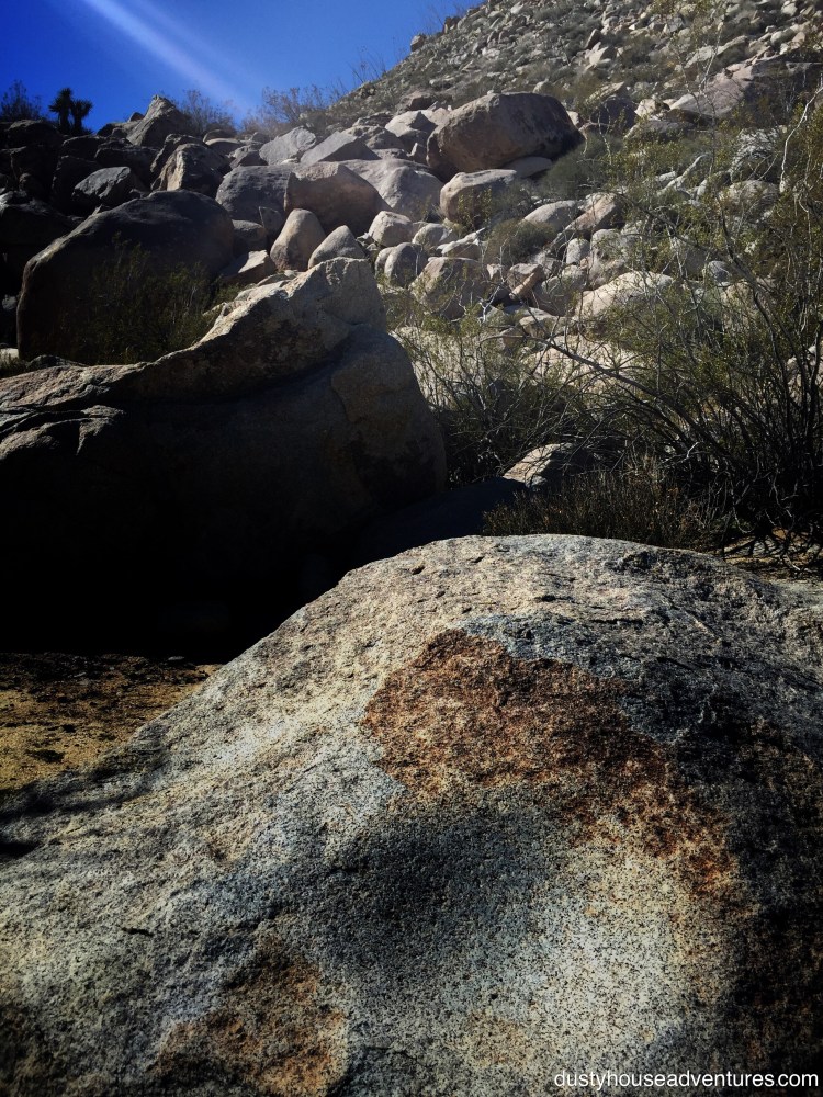
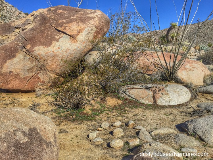
After gawking at the pictograph panel for a while I started following the trail again down the middle of the wash, then I thought, what the heck am I doing? I’m not going to see anything interesting in the middle of a well traveled wash! So I started scanning the boulders at the base of the hill for better stuff. More often than not, in an area where you know there’s been habitation, enormous boulders pay off. There’s either a rock shelter under it, rock art on it, artifacts discarded near it, grinding holes on bedrock nearby, or all of the above. I saw a big boulder. I moved in. Although the boulder itself didn’t seem to have much to recommend it, it was at the base of a rock fall an on the top of another boulder a few yards away was a tiny little stone stack. My antenna started to vibrate. “What’s over there!?!” The question became, should I continue down the wash on the established trail or start scrambling these random boulders to see what someone was trying to tell me I might find? I heaved a deep sigh then said to myself, “I guess I’m going to climb that.”
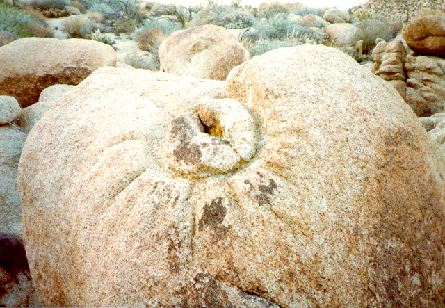
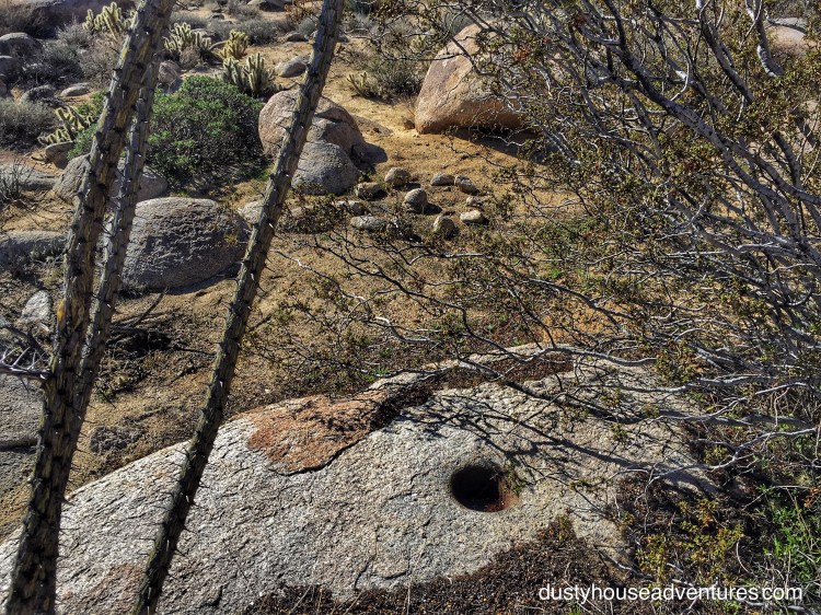
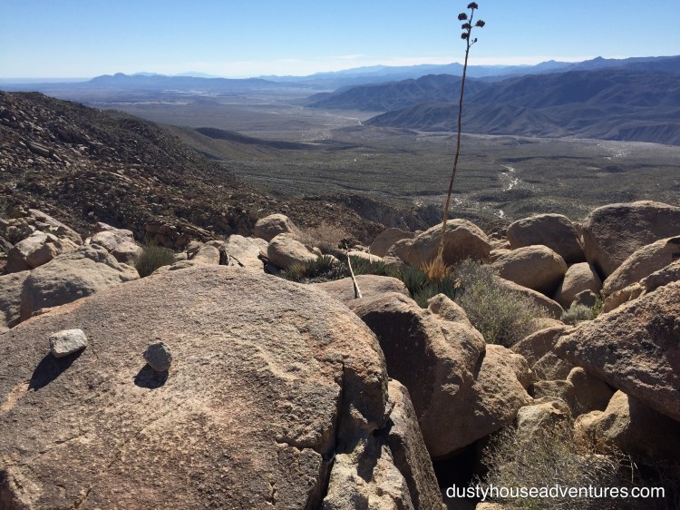
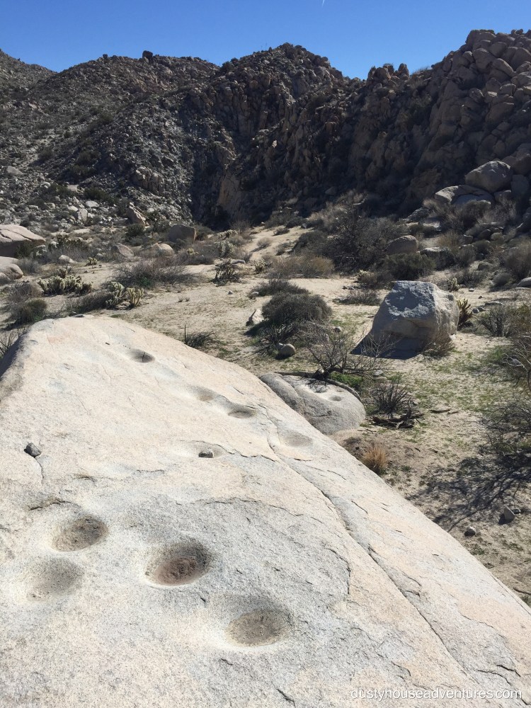
The first cairn led to another as I scrambled boulders up the hillside then popped out on a beautiful mesa top! From the floor of the wash the hill looks like an impenetrable stack of boulders and a nightmare to try to hike over. But on top there was actually a lovely flatfish mesa that looks like it used to collect a lot of water. It was exposed to big sky above, barely interrupted by the further rise of a hill, and a cliff edge that offered an expansive view of Carrizo Valley and the sunrise over the distant mountains to the east. Those boulders delivered me from protected, snug, cozy, homey Smugglers Canyon to a celestial observatory. I know this for sure because the first thing I saw was a stone circle geoglyph next to a single bedrock mortero (grinding hole) and small rock shelter.
In the archaeological paper called “Evaluation of Early Human Activities and Remains in the California Desert” (by Davis, Brown, and Nichols), the importance of these small stone circles with a central target stone is discussed. It is proposed that these stone circles that are less than a meter wide were used as solstice and equinox calendars. Knowing these dates would be very important to people who moved and harvested with the seasons. I did this research after returning from my trip during which I saw these stone circles and other directionally accurate geoglyphs and rock alignments over and over again in the Anza Borrego desert.
These little stone circles don’t look like fire rings, they somehow seem too deliberately placed. They also have other features: they have a central target stone, they seem to be found isolated on mesa tops, and sometimes they have stones on the outside of the circle that inform their orientation.
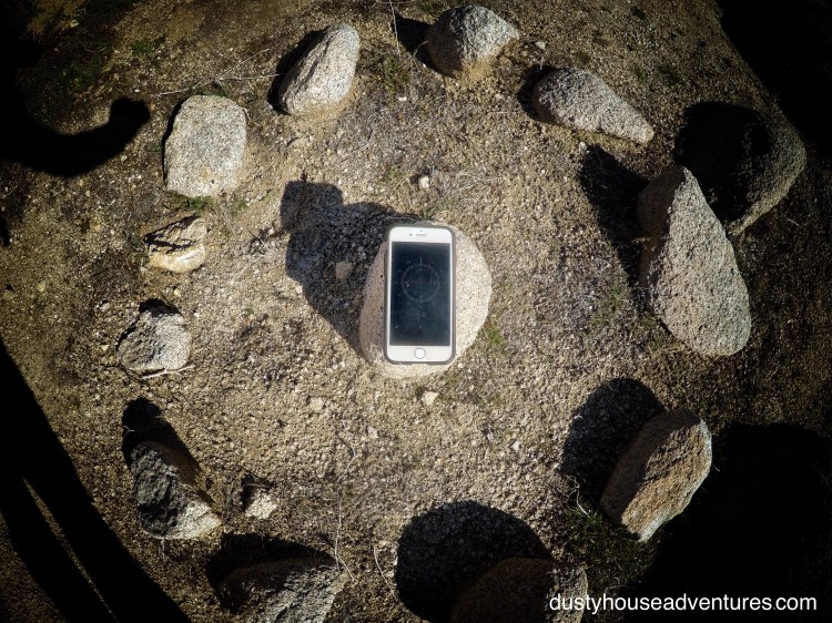
This circle stone had a rock that pointed into the circle at the Due East point. That “pointer rock” also had a bigger boulder lined up behind it. I propose that this alignment would correspond to sunrise at the Spring Equinox, when it was time to pack up and start heading back up the mountain after a nice temperate winter in the desert. My electronic compass in the picture above points to magnetic North which is about 13° west of true north. If the adjustment was made so that my compass pointed true north, then the pointer rock would move a little south on the compass making it align perfectly with sunrise at Spring Equinox at this latitude. I’m very excited by this.
I think this mesa top was used as a ceremonial space for sky worship. It doesn’t appear to be a village site because I didn’t see any other grinding holes as always appear in villages around there. As I was looking around I was thinking, “If I’m a sky worshipping Kumeyaay, where else would I want to be to observe the sky?” (That’s code for, “Self, think like a Kumeyaay and you’ll probably find more archaeological artifacts.”) I looked around me and realized that I would definitely want to be near the edge of the cliff to get an uninterrupted view of the big night sky that extended from the distant mountains. I walked over the mesa to cliff’s edge and was rewarded with a celestial observation platform. Something else that was mentioned in “Evaluation of Early Human Activities…” to be found with the little sun circles.
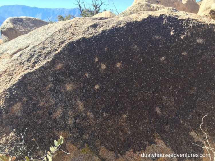
Tucked behind the observation platform was a blackened desert varnish covered rock with pock marks chipped out of it. I wonder if these chips are petroglyphs representing a constellation. I realize that I need to learn a lot more about the night sky so that I can appreciate evidence of the old ways much better. I bought a book about that and am determined to get a little smarter.
I always prefer to explore new ground than retrace my steps so I decided to try to get back to Smuggler’s Canyon by scrambling around the bouldery cliff at the edge of the mesa.
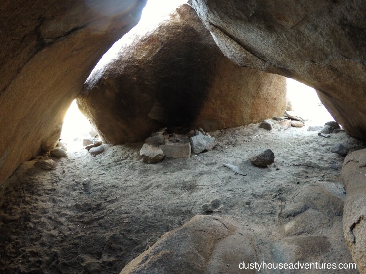
I popped out of the boulders overlooking a big village site with lots of morteros, shade, and rock shelters.
I read that water probably gathered in a pond at the base of the canyon before spilling out through the slot canyon and over the waterfall.
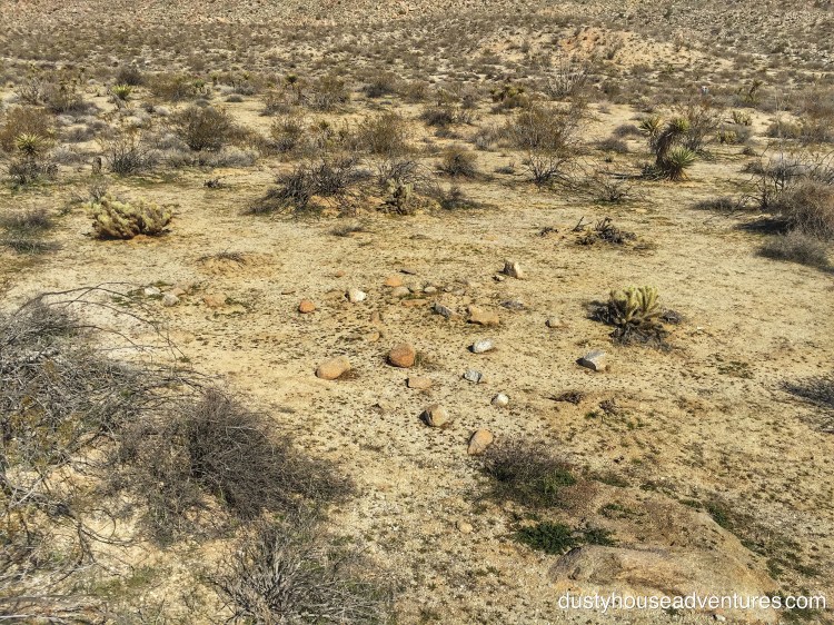
On the hike out of the canyon I saw this odd scattering of rocks. I wonder if they are lying on top of what used to be an agave roasting pit?
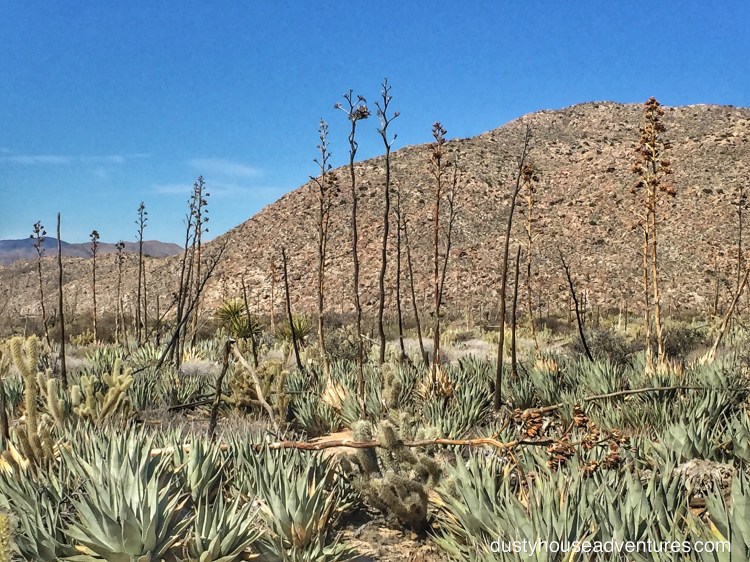
There are agave fields all over around here. There was a lot to eat.
A little hike that I thought would take me an hour ended up taking half the day. There was much more I wanted to see. Since I was beginning to understand that the sun and the stars were very important to the Kumeyaay it became important for me to try to find some geoglyphs — stone alignments and enormous etchings in the hard desert floor — that I read could be found in the Yuha Desert. I was off to try to find some.