My buddy “Ted Bundy” (trail name) and I lunged head first in to an expedition to hike to “The Remotest Ghost Town In America”, Beveridge Ghost Town, in the Inyo Mountains, California.
Let me tell you a thing or two about Ted Bundy and myself. We are both fantasists with an infinite capacity for denial, self delusion, and overconfidence. We are experienced, responsible, good planners, good leaders, and have a can-do attitude therefore when faced with the prospect of doing something that trail writers call the “hardest hike in Death Valley” the warning doesn’t truly penetrate our shiny happy excitement at the challenge. The thing I find myself saying to myself all the time is, “I’ll figure it out”, and I usually do.
Beveridge was an attractive destination for all of the following reasons: It was an 1870s gold mining boom town nestled in Beveridge Canyon at 6,200 ft above sea level just outside the border of Death Valley National Park. It is extremely remote, accessible by ascending over a mountain from the desert floor then plummeting back down into the canyon. There is only a narrow window of weather during which it is accessible because of extreme heat or extreme cold (and it is impossible to totally avoid both). The obvious water source through town is reported to be laced with cyanide. And there are biting flies to torment travelers along the way. Paradise, right?
We made good friends with the hike description and instructions provided by explorer Matt Clapp at https://ilivenow.com (Matt, if you’re reading this, know that many an appreciative word was said about you on the trail). We appreciated the detail he put into his trail descriptions and cautions, complimented his generosity in suggesting little things like cutting your toenails before the hike out. We honored Matt and clutched his trail description to our breasts with gratitude and enthusiasm, then proceeded to ignore everything he said and try to do it our own way.
Our adventure started at Panamint Springs Resort. Matt advised to get a 5am “alpine start” hiking the trail, we woke up at around 6am and began to pack. Once we were ready to go we threw the I Ching to ask if we would be successful. Note that neither of us know how to throw the I Ching correctly, but we felt that metaphysical truth would find us no matter how we threw the coins, so we cast. We asked, “will we be successful hiking to Beveridge?” The I Ching responded,
Ta Ch’u, The Taming Power Of The Great:
Heaven within the mountain:
When innocence is present, it is possible to tame.
Were we innocent? We determined that we felt right innocent, good, pure, and more than that, righteous. Good ‘nuf. Onward.
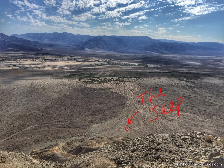
From Panamint Springs it took about two hours to reach the trailhead compared to what in my eyeball estimation of the map would be 30 minutes. Death Valley has the largest area of designated national park in the contiguous United States, and most of its roads require a 4wd vehicle. Distances are lengthened considerably when difficult terrain is an obstacle, but why take that into consideration when eyeballing a map? We parked at the cabin at the base of Beveridge Canyon. The cabin is fantastic.
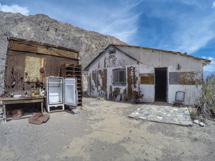
The house is sweet, cozy, historic, and on my list of first class vacation homes that come with hanta virus warnings stapled to the wall.


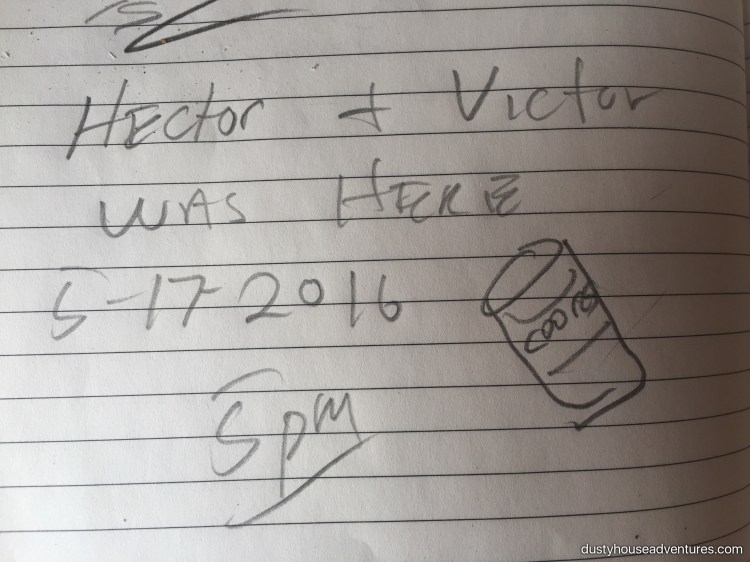
We were quite fond of visitors Hector and Victor who signed the guest book with a sketch of a Coors beer can.
We wiped the 10am sweat from our brows, hefted our packs and strode confidently up the wrong trail. So eager to begin we misread the instructions and began hiking up Beveridge Canyon instead of going further along the mountain to the correct trailhead.
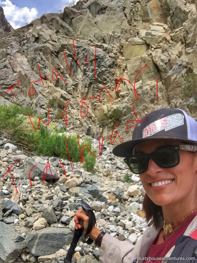
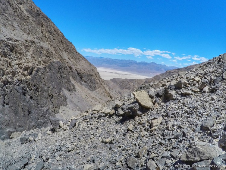
We only hiked for about 1/4 of a mile before realizing that we were idiots and turned around to go back to the car. The last mile of the (correct) drive to the trailhead of the Snowflake Mine Trail was extremely difficult and would have been impossible in any vehicle besides my jeep. The terrain is washed away with shallow ravines striating the intersecting the path.
Like mad dogs and Englishmen we hiked up that god damned, hot as hell, shadeless, 30 degree incline “impassable road” in the noon day sun. For someone who puts in as many trail miles as I do in a week 2.3 miles is laughable, but I wasn’t laughing. Well that’s not true at all. We were both laughing our asses off at how ridiculously difficult it was to hike “the impassable road” in that heat carrying full packs of gear plus 6-8 liters of water/Gatorade each. For as much time on the clock we spent hiking, we spent an equal amount of time lying in a ditch under my sunblock umbrella eating Snickers bars and drinking Gatorade. During one nearly catatonic moment of repose I reached for my phone/camera to take a selfie and noticed in the camera that Ted Bundy had secretly put his head down and was sneaking a nap. I snapped the picture catching him at it, but he made me swear not to post it on Facebook or anything. I’m good to my word, but he never said I couldn’t tell you all about it. Haha! Winning!
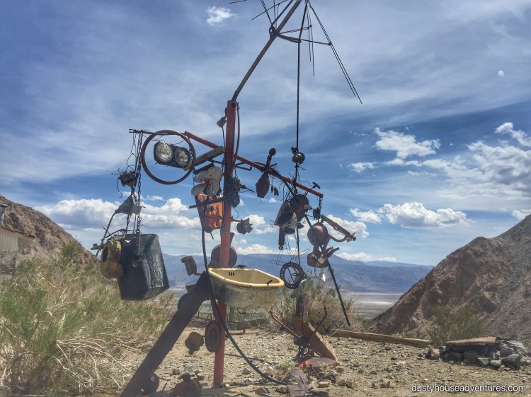
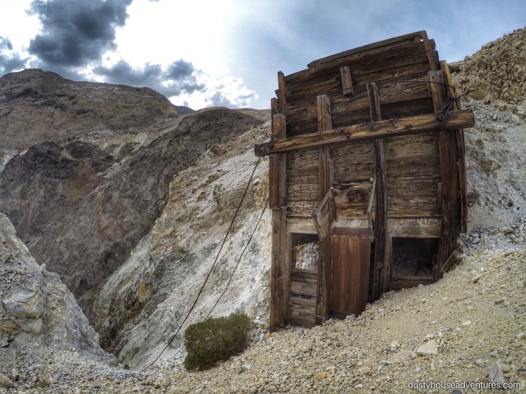
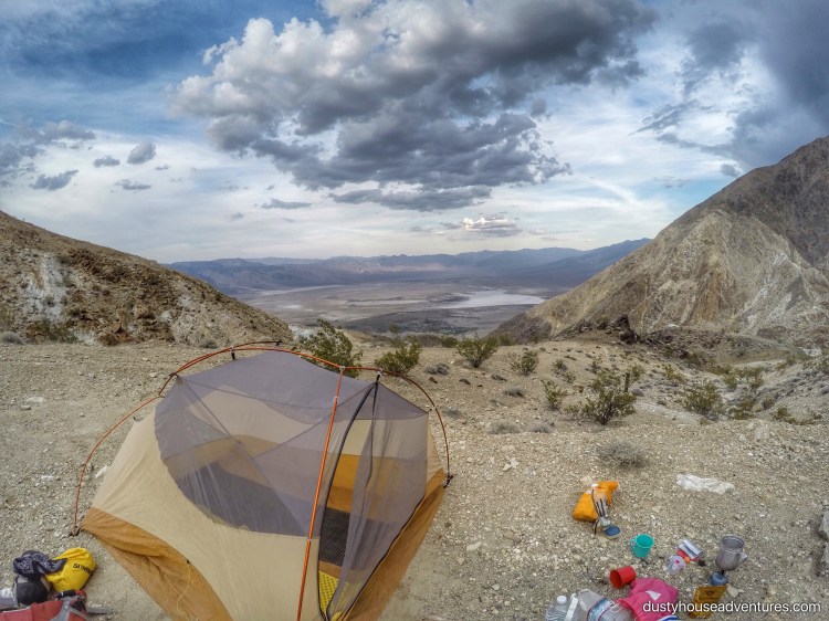
Shortly after passing the Snowflake Talc Mine and admiring its gorgeous, primitive construction, we finally reached “the trailhead” as storm clouds gathered overhead. We had attained the base of “The Great White Wall” and collapsed at its feet to rest.
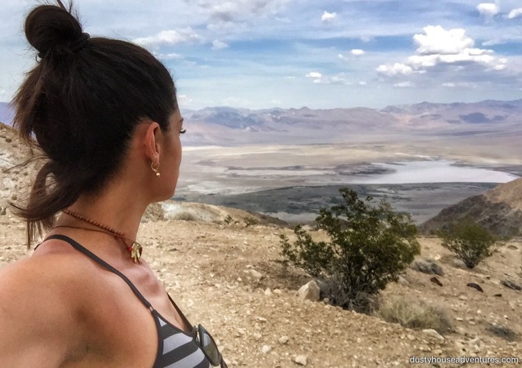
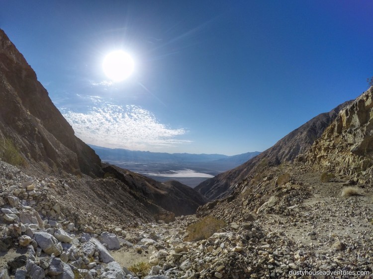
Gray angles and edges stabbed out of the earth at us and toward the smoldering sky. The salt flats of Saline Valley below shimmered a mirage against the floor of its ancient desiccated lake bed. “The Great White Wall” gently smiled in its repose. For a moment we had grace. And then the sandflies.
At first Ted Bundy was the only one suffering. He ankles seemed to have just the flavor that biting sand flies crave, but I guess sweaty girls are equally delicious and soon we were both slapping and scratching too much to bear. Then the wind. High winds blew the flies away, but replaced that threat with a storm. With some difficulty we erected the the tent, cooked some dinner, and dove inside with bean burritos to watch the show. As darkness came so did the rain and I think we already knew that this was the end.
Matt Clapp warned not to proceed over “The Great White Wall”, which he also called “the point of no return”, to Beveridge if it is raining. The water erosion on this entire mountain makes it obvious that flash floods are the concern. We’d heeded none of this sage man’s advice on the entire trip and had paid the price, but we were determined not to die fools. It rained off and on through the night and we were safe on our perch, but in the morning clouds remained. There are no weather stations in this remote mountain wilderness. It is impossible to forecast the weather there even from town on a computer, and with no access to any such resource we couldn’t even guess at what the coming day would hold. We pulled the plug on hiking all the way to Beveridge this trip, kissed “The Great White Wall”, apologized for our arrogance, and asked its permission to return with more humility and be granted passage.

Fantasists, one who confuses fantasy and what is real. I love this saying, “then proceeded to ignore everything he said and try to do it our own way”, LOL. Looks like one hell of a hike.